


Street View can reveal demographic profiles
Images readily available on Google Street View can uncover an unnerving amount of information about neighbourhood demographics, income and voting preferences


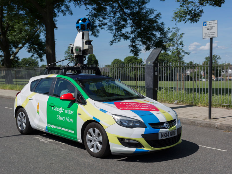
The research project analysed 22 million cars visible on Google Street View using artificial intelligence
The car that someone drives can reveal a lot about them. In fact, the Stanford Artificial Intelligence Laboratory has discovered that by totting up the number of Sedans and pickup trucks seen on a drive through a US city, it’s possible to predict that city’s voting preference with over 80 percent accuracy. Pickup trucks are associated with Democrats, while neighbourhoods with Sedans tend to vote Republican.
This technique is part of the fast-growing field of big data research that is receiving an increasing amount of attention from businesses and governments looking to gain fast access to more accurate demographic data.
The research project analysed 22 million cars visible on Google Street View using artificial intelligence, and discovered that it is possible to accurately estimate income, race, education and voting patterns at the neighbourhood level.
Big data research is receiving an increasing amount of attention from businesses and governments looking to gain fast access to more accurate demographic data
The researchers used deep learning computer vision techniques on 50 million images to identify the make, model and year of the cars present in each neighbourhood. They then used this data to make predictions about the demographic makeup of neighborhoods. These predictions are accurate even at the precinct level, which usually consists of a population of around 1,000 people.
The research team’s goal was to create a tool that would assist policymakers in collecting census-like data. The particular focus was the American Community Survey (ACS), a yearly survey that reports demographic results for every city in the US with a population of at least 65,000 people.
The Google Images algorithm is seen as a complementary technique that will fill in the gaps left by traditional survey methodologies. It can be used, for instance, to collect data on smaller neighbourhoods that are currently skipped by ACS survey teams. It is also far quicker: the lag-times associated with labour-intensive door-to-door surveys can be virtually eliminated.
There is no indication that these algorithms will be released into the public domain. So, as of yet, it won’t be possible for members of the public to check the affluence, racial makeup or voting preferences of a neighbourhood.
However, the images that have been used are available to the public, so there is nothing to stop others pursuing similar projects. Businesses looking to expand or relocate, for instance, may be interested in an area that is more affluent, or they may seek out a particular demographic profile. Additionally, political parties may be able to harness this kind of information in targeted campaigning.